Mount Moosilauke
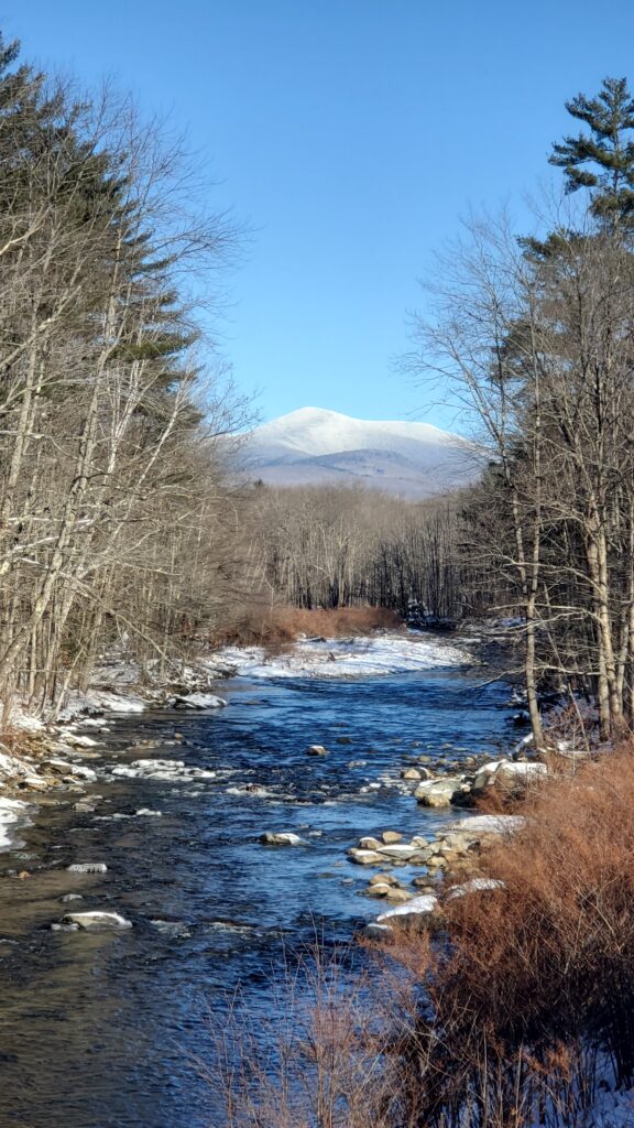
First things first, how do you pronounce it? Is the “e” silent or not? Well the true answer is either way is acceptable, but most locals use the silent “e”. So now that we have that out of the way, let’s dig in to this gorgeous mountian.
Mount Moosilauke is a 4,802-foot-high (1,464 m) mountain at the southwestern end of the White Mountains in the town of Benton, New Hampshire, United States. It is the tenth highest and most southwesterly of the 4,000 foot summits in the White Mountains. Moosilauke is ranked 9th on the New England Fifty Finest peaks, a list of summits with the highest topographic prominence. The Appalachian Trail passes over the mountain. It is sometimes referred to as the “Gentle Giant”.
The name Moosilauke (with its many variant spellings) is derived from the Abenaki language. The most common translation is “bald place”. However, the derivation of place names from Algonquian languages is often quite uncertain, and other possible translations of Moosilauke include “at the place of ferns”, “at the smooth place on the summit” and “good moose place along the brook”
Mount Moosilauke is made up of metamorphic rock called the Littleton Formation which is Lower Devonian in age. The Littleton Formation is primarily a mica schist with zones containing garnet and staurolite-sillimanite. The unit also contains interbedded amphibolites. The mica schist started out as clay-rich mud in a marine basin that probably formed during the early Acadian Orogeny. The amphibolites may represent metamorphosed submarine basalt flows. Pegmatite dikes cross-cut the Littleton Formation and can be seen from the Gorge Brook Trail as it nears treeline. These pegmatites are likely related to the geology to the east of the mountain which is dominated by the Kinsman quartz monzonite. This Acadian-aged igneous rock can be seen at the Kinsman Notch / Beaver Brook pond area.
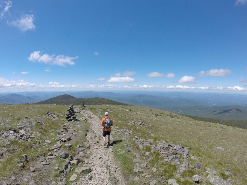
The summit of Moosilauke is treeless and offers panoramic views of the Kinsmans to the north, the Presidential Range and Franconia Ridge to the northeast, the heart of the White Mountains to the east, Lake Winnipesaukee and neighboring lakes to the southeast, and the Green Mountains and Adirondacks to the west, along with great views closer in to numerous glacially-carved ravines on Moosilauke’s shoulders. The first winter high country weather observatory was set up at the top of Mt. Moosilauke in the winter of 1869-1870.
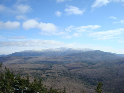
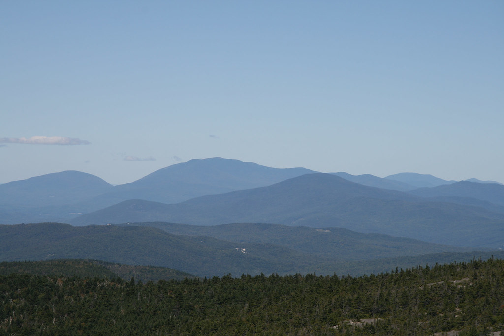
Moosilauke has numerous subsidiary peaks, including Mount Blue, elevation 4,529 feet (1,380 m), to the north of the summit, and the South Peak, elevation 4,523 feet (1,379 m), between the Carriage Road and Glencliff Trail, about one mile southwest of the main peak. The South Peak, reached by a 0.2-mile (0.32 km) spur trail, is particularly noted for its fine views of the main summit ridge, into the deep Tunnel Brook Ravine to neighboring Mt. Clough and westward into the Connecticut River valley and Vermont beyond.
The most commonly climbed route to the summit is the Gorge Brook Trail from Ravine Lodge. One can make a loop by returning via the Carriage Road and Snapper Trail. Other trails to the summit include the Glencliff Trail from the southwest, the Benton Trail from the north, the Beaver Brook Trail ascending very steeply past numerous waterfalls from Kinsman Notch to the northeast, the Carriage Road from the south and the Asquam Ridge Trail from the southeast. The Appalachian Trail, from south to north, utilizes the Glencliff, Carriage Road, Benton and Beaver Brook trails.
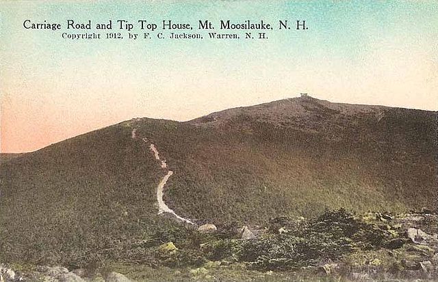
In 1860, Darius Swain and James Clement built the Prospect House on the summit of Mt. Moosilauke. It was later known as the Tip-Top House of Mt. Moosilauke. In 1870, a well-made carriage road (it was a state-chartered toll road and collected tolls until 1919) was built up the mountain and many more visitors were attracted. (The date of the construction of the road is quoted by different authors as being 1860, 1870, and 1881.) It was in this mountaintop hotel that J.H.Huntington, a college student, recently graduated from Amherst College, and A.F. Clough, a photographer from Warren, spent the winter of 1869-70. It was the first attempt at spending a winter on a mountaintop and both men were part of the group that spent the next winter at the summit of Mt. Washington. The hotel expanded by the addition of a wooden ell in 1872 and a wooden superstructure was added to the original house. As on Mt. Kearsarge, enthusiastic businessmen considered building a railroad to the summit. In 1889, the Moosilauke Railroad was incorporated. It was to run from Warren to the summit of Mt. Moosilauke but never built. The survey report of F.W. Conn, dated Jan. 29, 1890, indicates that there had been some discussion of building a cog railway, but the report recommended against it.
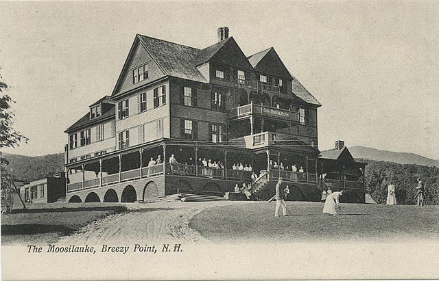
Breezy Point Road leads to the Carriage Road trailhead. Nathaniel Merrill built a farmhouse there in 1834, and converted the farmhouse in 1860 to serve as an inn called the Merrill Mountain Home. Slightly downhill from there, the larger Breezy Point House “The Moosilauke” was built in 1877. The resort featured a 9 hole golf course and guests could ride to the top of Moosilauke by horse and buggy up the carriage road. It was destroyed by a fire in 1884, and then the Moosilauke Inn was built there in 1886. In 1915, the Merril Mountain burned down, and in 1953, the Moosilauke Inn burned down. Just a concrete slab remains today, but the views are still spectacular.
Some amazing photos of Mousilauke’s History
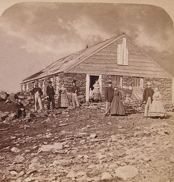 When the Hotel was built in 1860, it was originally known as The Prospect House. Photo c.1870. Courtesy American Anitiquarian Society
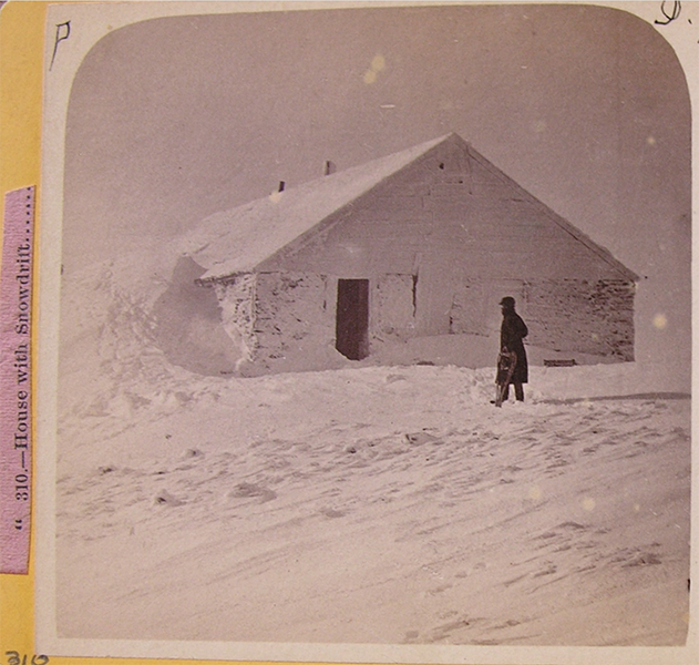 Mt. Mooselauke in Winter of 1869-70. Photo A.F. Clough. Courtesy American Antiquarian Society
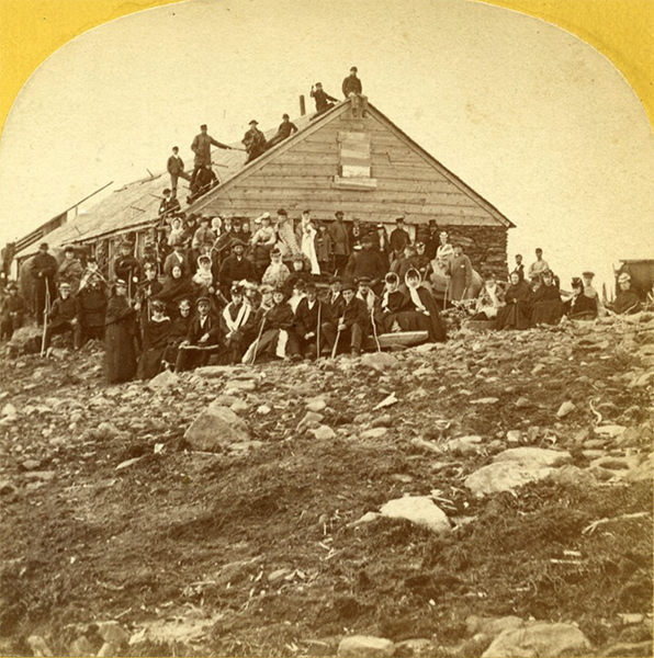 Normal School Visiting Tip Top House, Mt. Moosilauke, 1877. Clough Photo. Courtesy Campton Historical Society
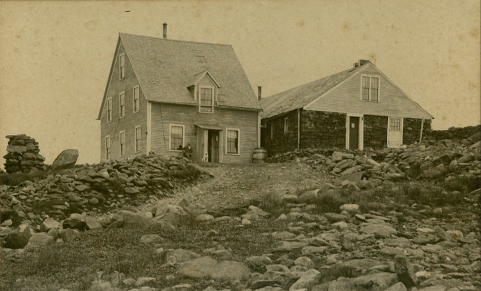 Tip Top House, Mt. Moosilauke, After Building the Wooden Ell in 1872
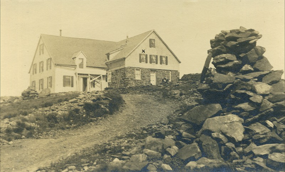 Tip Top House, Mt.Moosilauke, Including 1899 Additions
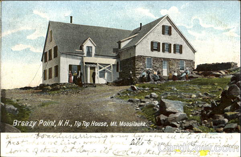 Painted Postcard with writing, Tip Top House, Mt. Moosilauke, c.1915
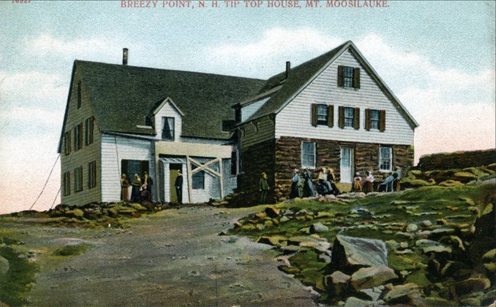 Different version of postcard with label on top, Tip Top House, Mt. Moosilauke, c.1915
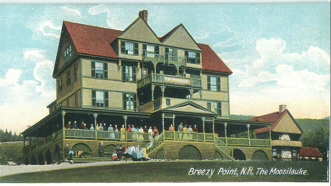 Different version of postcard with label on top, Tip Top House, Mt. Moosilauke, c.1915
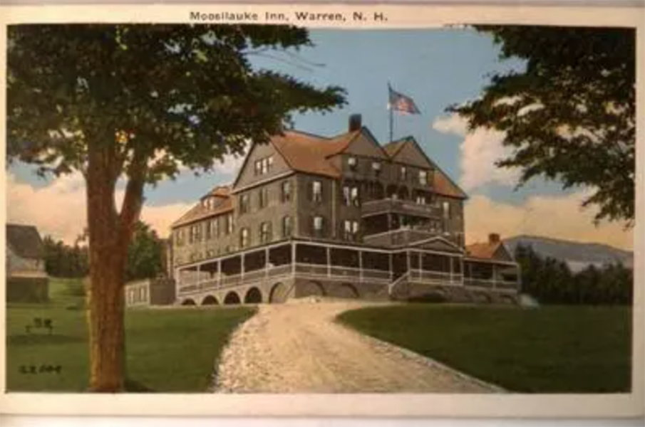 "The Moosilauke" Inn, Built 1886, Destroyed by fire 1953
